HOW DOES IT WORK?
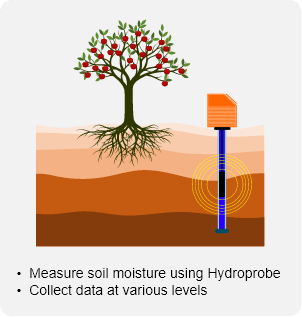
JTM makes use of physical ‘in the ground’ monitoring technology coupled with weekly site visits to gather the necessary data to optimally manage the farms water resources. Data is collected on rainfall, management of effective root depth as well as water usage.
Step 1: Site selection
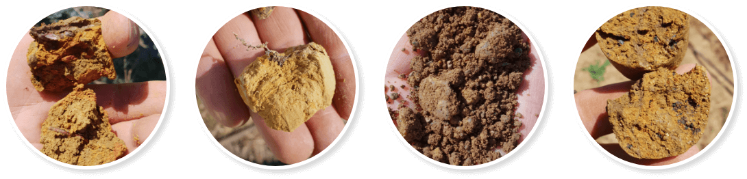
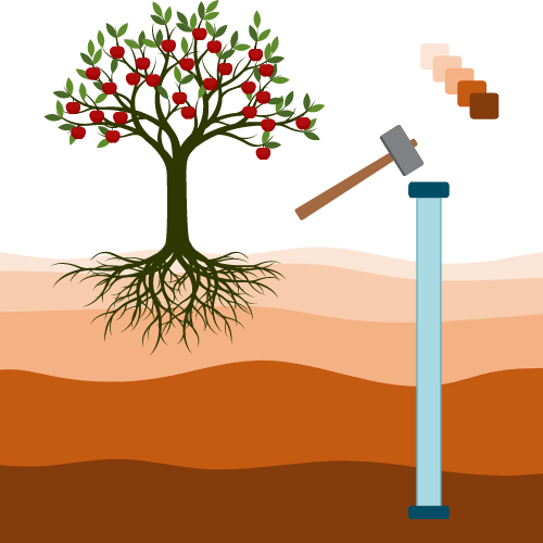
Farms are typically divided into manageable sections called blocks. To get an accurate picture of the farms water usage, sites need to be identified in each block which is representative of its features. Depending on the characteristics of a block there may be as few as 1 site or as many as 3 sites identified. Factors like the size, type of soil and gradient of the block affect the selection and quantity of sites. Each site is selected through a physical analysis of the environment. This takes the form of both a visual inspection as well as a comprehensive soil and root analysis process. A hole of about 40mm in diameter is created using a metal pipe that is hammered into the soil and soil samples are taking every 50mm. Holes vary from 1.2m to 2m in depth. Data is collected on each soil sample including its water capacity and composition, then logged.
Step 2: Initial readings & site grid development
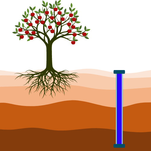
Once a site has been profiled and the metal shaft is removed, a PVC pipe is inserted in its place in preparation of the Hydroprobe instrumentation that will be used. The PVC pipe acts as an access tube that allows the Hydroprobe to collect data on the moisture levels in the soil. Once the access tube is in place a Hydroprobe is inserted and initial readings are taken every 100mm. The data is collected, and the site is marked and labelled on a grid map using GPS co-ordinates.
Step 3: Initial farmdata profile setup
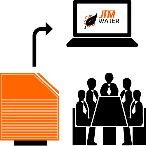
Once all the blocks on the farm have had sites identified, installed and initial readings taken, the Hydroprobe is connected to a computer and the data downloaded. This in conjunction with the collected data is used to create the baseline for the farm’s data profile. Once the profile is complete the information is uploaded to our cloud-based water management app. From that day forward the farmer will have a comprehensive picture of his farm’s water profile, easily accessible via our web based app.
Step 4: Weekly readings
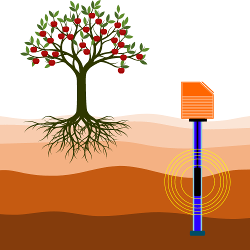
With the baseline data in place a weekly site visit is scheduled. As the consultant moves through the farm stopping at each site. The log number associated with that site is entered into the Hydroprobe. Measurements are taken manually using the Hydroprobe which gathers data every 100mm down the access tube of each site. It does this by transmitting a low-level radio isotope into the soil. Readings are then taken in 15-30cm diameter radius. Compared to a Continuous Logger (which only gathers a 1cm diameter’s worth of data and is affected by temperature fluctuations), the Hydroprobe delivers a far more reliable and comprehensive soil sample test. Not only do you get a higher volume of data, but you get better quality as well.
The purpose of the schedule is not only to collect data from each site and block, but also to do visual inspections of the soil, crop and irrigation to ensure that all variables are considered when doing the analysis.
For example, a credible reason a site might experience too much or too little moisture at root level could be based on environmental factors such as the wind or rainfall levels. It could also be that the irrigation servicing that site is defective. The only way to know for sure is to do both a visual inspection as well as take accurate measurements.
Our weekly visits can be followed by a short consultation with the farmer or representative to discussed and present recommendations created from our findings, alternatively a short report if requested in addition to the information given to the farmer via the web app.
Our “feet-in-the-field” philosophy therefore results in a holistic hands-on approach that delivers better data. When that data is coupled with optimal irrigation cycles that are planned to accommodate for rainfall, wind, temperature as well lunar cycles we can more accurately model and advise the farmer on future irrigation needs. This helps the farmer use less water to achieve a better-quality crop.
Step 1: Site selection
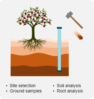
Farms are typically divided into manageable sections called blocks. To get an accurate picture of the farms water usage, sites need to be identified in each block which is representative of its features. Depending on the characteristics of a block there may be as few as 1 site or as many as 3 sites identified. Factors like the size, type of soil and gradient of the block affect the selection and quantity of sites. Each site is selected through a physical analysis of the environment. This takes the form of both a visual inspection as well as a comprehensive soil and root analysis process. A hole of about 40mm in diameter is created using a metal pipe that is hammered into the soil and soil samples are taking every 100mm. Holes vary from 1.2m to 2m in depth. Data is collected on each soil sample including its water capacity and composition, then logged.

Step 2: Initial readings & site grid development
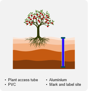
Once a site has been profiled and the metal shaft is removed, a PVC pipe is inserted in its place in preparation of the Hydroprobe instrumentation that will be used. The PVC pipe acts as an access tube that allows the Hydroprobe to collect data on the moisture levels in the soil. Once the access tube is in place a Hydroprobe is inserted and initial readings are taken every 100mm. The data is collected, and the site is marked and labelled on a grid map using GPS co-ordinates.
Step 3: Initial farm
data profile setup
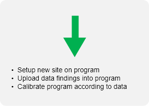
Once all the blocks on the farm have had sites identified, installed and initial readings taken, the Hydroprobe is connected to a computer and the data downloaded. This in conjunction with the collected data is used to create the baseline for the farm’s data profile. Once the profile is complete the information is uploaded to our cloud-based water management app. From that day forward the farmer will have a comprehensive picture of his farm’s water profile, easily accessible via our web based app.
Step 4: Weekly readings
With the baseline data in place a weekly site visit is scheduled. As the consultant moves through the farm stopping at each site. The log number associated with that site is entered into the Hydroprobe. Measurements are taken manually using the Hydroprobe which gathers data every 100mm down the access tube of each site. It does this by transmitting a low-level radio isotope into the soil. Readings are then taken in 15-30cm diameter radius. Compared to a Continuous Logger (which only gathers a 1cm diameter’s worth of data and is affected by temperature fluctuations), the Hydroprobe delivers a far more reliable and comprehensive soil sample test. Not only do you get a higher volume of data, but you get better quality as well.
The purpose of the schedule is not only to collect data from each site and block, but also to do visual inspections of the soil, crop and irrigation to ensure that all variables are considered when doing the analysis.
For example, a credible reason a site might experience too much or too little moisture at root level could be based on environmental factors such as the wind or rainfall levels. It could also be that the irrigation servicing that site is defective. The only way to know for sure is to do both a visual inspection as well as take accurate measurements.
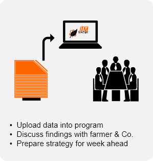
Our weekly visits can be followed by a short consultation with the farmer or representative to discussed and present recommendations created from our findings, alternatively a short report if requested in addition to the information given to the farmer via the web app.
Our “feet-in-the-field” philosophy therefore results in a holistic hands-on approach that delivers better data. When that data is coupled with optimal irrigation cycles that are planned to accommodate for rainfall, wind, temperature as well lunar cycles we can more accurately model and advise the farmer on future irrigation needs. This helps the farmer use less water to achieve a better-quality crop.